Webcam provided by windy.com — add a webcam

BC
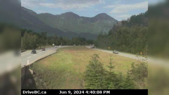
Hope › East: Hwy 1 at Hunter Creek, looking east
Hope › East: Hwy 1 at Hunter Creek, looking east

Agassiz, BC
Hwy-1 at Hunter Creek, looking east. (elevation: 40 metres)
Hwy-1 at Hunter Creek, looking east. (elevation: 40 metres)

BC
Hope › West
Hope › West

BC
Hope › North-East: Hope Regional Airpark
Hope › North-East: Hope Regional Airpark

Agassiz, BC
Hwy-7, about 2 km west of Hope, looking east. (elevation: 74 metres)
Hwy-7, about 2 km west of Hope, looking east. (elevation: 74 metres)

Agassiz, BC
Hwy-7, about 2 km west of Hope, looking west. (elevation: 74 metres)
Hwy-7, about 2 km west of Hope, looking west. (elevation: 74 metres)

BC
Hope 1 › West: Hwy 1 at Hwy 7 near Hope, looking west
Hope 1 › West: Hwy 1 at Hwy 7 near Hope, looking west

Agassiz, BC
Hwy-1 at Hwy-7 near Hope, looking west. (elevation: 85 metres)
Hwy-1 at Hwy-7 near Hope, looking west. (elevation: 85 metres)

BC
Harrison Hot Springs › West: Hwy 1 at Herrling Island overpass westbound, looking west
Harrison Hot Springs › West: Hwy 1 at Herrling Island overpass westbound, looking west

Agassiz, BC
Hwy-1 at Herrling Island overpass, looking south. (elevation: 81 metres)
Hwy-1 at Herrling Island overpass, looking south. (elevation: 81 metres)

Agassiz, BC
Hwy-1 at Herrling Island overpass, westbound looking east. (elevation: 81 metres)
Hwy-1 at Herrling Island overpass, westbound looking east. (elevation: 81 metres)

Agassiz, BC
Hwy-1 at Herrling Island overpass westbound, looking west. (elevation: 81 metres)
Hwy-1 at Herrling Island overpass westbound, looking west. (elevation: 81 metres)

Agassiz, BC
Hwy-1 at Herrling Island overpass, looking north. (elevation: 81 metres)
Hwy-1 at Herrling Island overpass, looking north. (elevation: 81 metres)

BC
Harrison Hot Springs › East: Hwy 1, near Herrling Island, looking east
Harrison Hot Springs › East: Hwy 1, near Herrling Island, looking east

Agassiz, BC
Hwy-1, near Herrling Island, looking west. (elevation: 48 metres)
Hwy-1, near Herrling Island, looking west. (elevation: 48 metres)