Webcam provided by windy.com — add a webcam

Sooke, BC
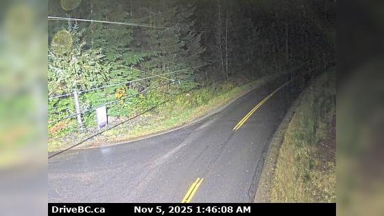
Hwy-14 near Cormorant Way/Trailhead Dr, looking east. (elevation: 57 metres)
Hwy-14 near Cormorant Way/Trailhead Dr, looking east. (elevation: 57 metres)

BC
Juan de Fuca Electoral Area › East: Hwy 14 near Cormorant Way/Trailhead Dr, looking east
Juan de Fuca Electoral Area › East: Hwy 14 near Cormorant Way/Trailhead Dr, looking east

Sooke, BC
Hwy-14 at Lazzar Rd near Sooke, looking east. (elevation: 22 metres)
Hwy-14 at Lazzar Rd near Sooke, looking east. (elevation: 22 metres)

Sooke, BC
Hwy-14 at Lazzar Rd near Sooke, looking west. (elevation: 22 metres)
Hwy-14 at Lazzar Rd near Sooke, looking west. (elevation: 22 metres)

Sooke, BC
Sooke › East: Hwy 14 at Lazzar Rd near - looking east
Sooke › East: Hwy 14 at Lazzar Rd near - looking east

Clallam Bay, WA
SR 112 at MP 23.1: Burnt Mt
SR 112 at MP 23.1: Burnt Mt

Sooke, BC
Sooke › East: Hwy 14 at Glinz Lake Road, looking east
Sooke › East: Hwy 14 at Glinz Lake Road, looking east

Sooke, BC
Sooke › North: Hwy 14 at Glinz Lake Road, looking north
Sooke › North: Hwy 14 at Glinz Lake Road, looking north

Sooke, BC
Sooke › East: Hwy 14 at Gillespie Rd, looking east
Sooke › East: Hwy 14 at Gillespie Rd, looking east

Sooke, BC
Sooke › West: Hwy 14 at Gillespie Rd, looking west
Sooke › West: Hwy 14 at Gillespie Rd, looking west

Sooke, BC
Hwy-14 at Kangaroo Rd, looking south (elevation: 85 metres)
Hwy-14 at Kangaroo Rd, looking south (elevation: 85 metres)

Sooke, BC
Hwy-14 at Kangaroo Rd, looking east. (elevation: 85 metres)
Hwy-14 at Kangaroo Rd, looking east. (elevation: 85 metres)

Sooke, BC
Hwy-14 at Kangaroo Rd, looking west. (elevation: 85 metres)
Hwy-14 at Kangaroo Rd, looking west. (elevation: 85 metres)

Metchosin, BC
Metchosin › South: Hwy 14 at Kangaroo Rd, looking south
Metchosin › South: Hwy 14 at Kangaroo Rd, looking south

Sooke, BC
Hwy-14, between Langford and Sooke near Suyer Rd, looking east. (elevation: 123 metres)
Hwy-14, between Langford and Sooke near Suyer Rd, looking east. (elevation: 123 metres)