Webcam provided by windy.com — add a webcam

BC
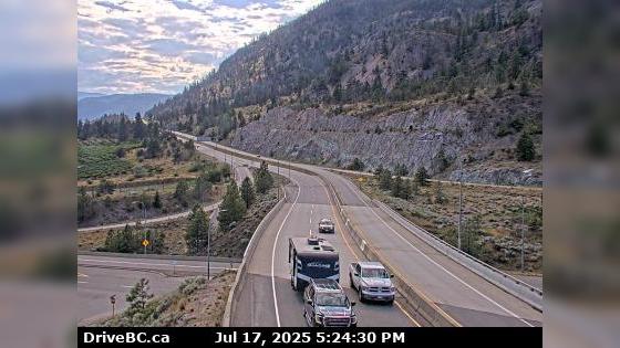
West Kelowna › West: Hwy 97 at Hwy 97C junction, about 5 km south of Westbank, looking west
West Kelowna › West: Hwy 97 at Hwy 97C junction, about 5 km south of Westbank, looking west

West Kelowna, BC
West Kelowna › North: Hwy 97 at Hwy 97C junction, about 5 km south of Westbank, looking north
West Kelowna › North: Hwy 97 at Hwy 97C junction, about 5 km south of Westbank, looking north

Peachland, BC
Peachland
Peachland

Kelowna, BC
Kelowna › West: Summerhill Pyramid Winery
Kelowna › West: Summerhill Pyramid Winery

BC
West Kelowna: Highway 97 near Westside Road
West Kelowna: Highway 97 near Westside Road

Kelowna, BC
Kelowna: COSA, Central Okanagan Sailing Association
Kelowna: COSA, Central Okanagan Sailing Association

Kelowna, BC
West end of WR Bennett Bridge connecting Kelowna and West Kelowna, looking west. (elevation: 344 metres)
West end of WR Bennett Bridge connecting Kelowna and West Kelowna, looking west. (elevation: 344 metres)

West Kelowna, BC
West Kelowna › West: West end of WR Bennett Bridge connecting Kelowna and - looking west
West Kelowna › West: West end of WR Bennett Bridge connecting Kelowna and - looking west

Kelowna, BC
Mid span of WR Bennett Bridge connecting Kelowna and West Kelowna, looking west. (elevation: 342 metres)
Mid span of WR Bennett Bridge connecting Kelowna and West Kelowna, looking west. (elevation: 342 metres)

West Kelowna, BC
West Kelowna › West: Mid span of WR Bennett Bridge connecting Kelowna and - looking west
West Kelowna › West: Mid span of WR Bennett Bridge connecting Kelowna and - looking west

Kelowna, BC
East end of WR Bennett Bridge connecting Kelowna and West Kelowna, looking west. (elevation: 343 metres)
East end of WR Bennett Bridge connecting Kelowna and West Kelowna, looking west. (elevation: 343 metres)

North Kelowna, BC
North Kelowna › West: East approach to WR Bennett Bridge at Abbott Street, looking west along Hwy
North Kelowna › West: East approach to WR Bennett Bridge at Abbott Street, looking west along Hwy

Kelowna, BC
East approach to WR Bennett Bridge at Abbott Street, looking west along Hwy-97. (elevation: 342 metres)
East approach to WR Bennett Bridge at Abbott Street, looking west along Hwy-97. (elevation: 342 metres)

Kelowna, BC
Kelowna: Sails and downtown pier
Kelowna: Sails and downtown pier

Kelowna, BC
Kelowna › South-West: Stuart Park Outdoor Ice Rink - BC - View of the ice surface and marina
Kelowna › South-West: Stuart Park Outdoor Ice Rink - BC - View of the ice surface and marina