Webcam provided by windy.com — add a webcam

Area A, BC
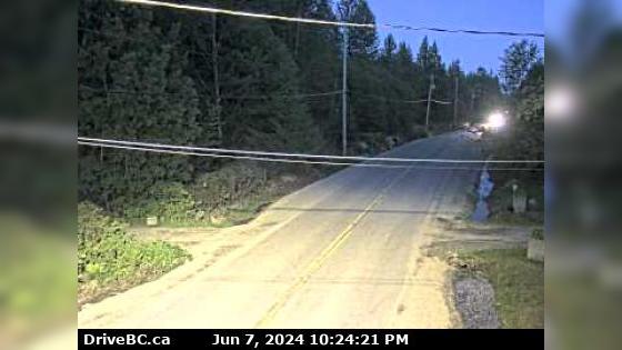
Area A › South: Hwy 101, about 8.5 km south of Lund, looking south
Area A › South: Hwy 101, about 8.5 km south of Lund, looking south

Powell River, BC
Powell River › West
Powell River › West

NS
Stillwater › South: Hwy 101 near Loubert Road in the qathet Regional District, looking south
Stillwater › South: Hwy 101 near Loubert Road in the qathet Regional District, looking south

Courtenay, BC
Courtenay › South: Intersection of Ryan Rd and Lerwick Rd in - looking south
Courtenay › South: Intersection of Ryan Rd and Lerwick Rd in - looking south

Courtenay, BC
Courtenay › North: Intersection of Ryan Rd and Lerwick Rd in - looking north
Courtenay › North: Intersection of Ryan Rd and Lerwick Rd in - looking north

BC
Area B › South: Comox Harbour - Comox Harbour Authority and the Beaufort Range on Vancouver Island
Area B › South: Comox Harbour - Comox Harbour Authority and the Beaufort Range on Vancouver Island

Courtenay, BC
Courtenay › East: Hwy 19A at Ryan Road in - looking eastbound
Courtenay › East: Hwy 19A at Ryan Road in - looking eastbound

Courtenay, BC
Courtenay › South: Hwy 19A at Ryan Road in - looking southbound
Courtenay › South: Hwy 19A at Ryan Road in - looking southbound

BC
Area B: Goose Spit
Area B: Goose Spit

Courtenay, BC
Courtenay › West: Hwy 19A at 17th Street Bridge in - looking west
Courtenay › West: Hwy 19A at 17th Street Bridge in - looking west

Courtenay, BC
Courtenay › North: Hwy 19A at 17th Street Bridge in - looking northbound
Courtenay › North: Hwy 19A at 17th Street Bridge in - looking northbound

BC
Area C › North: Hwy 19 at Hamm Road, about 25 km north of Courtenay, looking north
Area C › North: Hwy 19 at Hamm Road, about 25 km north of Courtenay, looking north

BC
Area C › South: Hwy 19 at Piercy Rd, looking south
Area C › South: Hwy 19 at Piercy Rd, looking south

Campbell River, BC
Campbell River › East
Campbell River › East

Campbell River, BC
Campbell River › North-East
Campbell River › North-East