
Hagensborg, BC
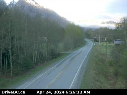
Hwy-20, between Bella Coola and Hagensborg, looking west. (elevation: 42 metres)
Hwy-20, between Bella Coola and Hagensborg, looking west. (elevation: 42 metres)

Point Roberts, WA
Hwy-20, about 88 km from Bella Coola and 41 km from Anahim Lake, near gate at top of Bella Coola hill, looking west. (elevation: 1515 metres)
Hwy-20, about 88 km from Bella Coola and 41 km from Anahim Lake, near gate at top of Bella Coola hill, looking west. (elevation: 1515 metres)

Point Roberts, WA
Hwy-20, near Anahim Lake, about 140 km east of Bella Coola, looking west. (elevation: 1100 metres)
Hwy-20, near Anahim Lake, about 140 km east of Bella Coola, looking west. (elevation: 1100 metres)

Burns Lake, BC
Hwy-35 at Southbank ferry landing on Francois Lake. (elevation: 729 metres)
Hwy-35 at Southbank ferry landing on Francois Lake. (elevation: 729 metres)

Port Hardy, BC
Hwy-19 at Hwy-30 (Port Alice Rd) junction, between Port Hardy and Port McNeill, looking south. (elevation: 85 metres)
Hwy-19 at Hwy-30 (Port Alice Rd) junction, between Port Hardy and Port McNeill, looking south. (elevation: 85 metres)

Sointula, BC
Hwy-19 at Campbell Way in Port McNeil, looking east. (elevation: 93 metres)
Hwy-19 at Campbell Way in Port McNeil, looking east. (elevation: 93 metres)

Sointula, BC
Hwy-19 at Campbell Way in Port McNeil, looking west. (elevation: 93 metres)
Hwy-19 at Campbell Way in Port McNeil, looking west. (elevation: 93 metres)

Burns Lake, BC
Hwy-35, near Martin Road midway between Burns Lake and the northern Francois Ferry Landing, looking south. (elevation: 760 metres)
Hwy-35, near Martin Road midway between Burns Lake and the northern Francois Ferry Landing, looking south. (elevation: 760 metres)

Burns Lake, BC
Hwy-35, near Martin Road midway between Burns Lake and the northern Francois Ferry Landing, looking north. (elevation: 760 metres)
Hwy-35, near Martin Road midway between Burns Lake and the northern Francois Ferry Landing, looking north. (elevation: 760 metres)

Burns Lake, BC
Hwy-16, about 32 km east of Burns Lake, looking east. (elevation: 729 metres)
Hwy-16, about 32 km east of Burns Lake, looking east. (elevation: 729 metres)

Burns Lake, BC
Hwy-16, in Burns Lake, at N. Francois Hwy, looking south. (elevation: 709 metres)
Hwy-16, in Burns Lake, at N. Francois Hwy, looking south. (elevation: 709 metres)

Burns Lake, BC
Hwy-16, in Burns Lake, at N. Francois Hwy, looking east. (elevation: 709 metres)
Hwy-16, in Burns Lake, at N. Francois Hwy, looking east. (elevation: 709 metres)

Burns Lake, BC
Hwy-16, in Burns Lake, at N. Francois Hwy, looking west. (elevation: 709 metres)
Hwy-16, in Burns Lake, at N. Francois Hwy, looking west. (elevation: 709 metres)

Fraser Lake, BC
Hwy-16, 48 km east of Burns Lake, looking east. (elevation: 691 metres)
Hwy-16, 48 km east of Burns Lake, looking east. (elevation: 691 metres)

BC
Savory › North-East: Hwy 16, 48 km east of Burns Lake, looking east
Savory › North-East: Hwy 16, 48 km east of Burns Lake, looking east