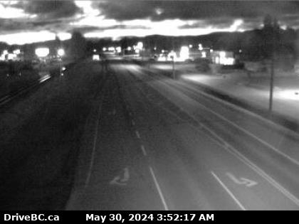

Houston, BC
Hwy-16 at North Nadina Avenue in Houston, looking east. (elevation: 595 metres)
Hwy-16 at North Nadina Avenue in Houston, looking east. (elevation: 595 metres)

Houston, BC
Hwy-16 at North Nadina Avenue in Houston, looking west. (elevation: 595 metres)
Hwy-16 at North Nadina Avenue in Houston, looking west. (elevation: 595 metres)

Houston, BC
Hwy-16 at North Nadina Avenue in Houston, looking north. (elevation: 595 metres)
Hwy-16 at North Nadina Avenue in Houston, looking north. (elevation: 595 metres)

Houston, BC
Houston › East: Hwy 16 at North Nadina Avenue in - looking east
Houston › East: Hwy 16 at North Nadina Avenue in - looking east

Houston, BC
Hwy-16 at Butler Avenue in Houston, looking east. (elevation: 600 metres)
Hwy-16 at Butler Avenue in Houston, looking east. (elevation: 600 metres)

Houston, BC
Hwy-16 at Butler Avenue in Houston, looking west. (elevation: 600 metres)
Hwy-16 at Butler Avenue in Houston, looking west. (elevation: 600 metres)

BC
Topley › West: On Hwy 16, 39 km west of Burns Lake looking west
Topley › West: On Hwy 16, 39 km west of Burns Lake looking west

BC
Topley › North: Granisle Hwy (Hwy 118), near summit. Approximately 14.5 km north of - looking north
Topley › North: Granisle Hwy (Hwy 118), near summit. Approximately 14.5 km north of - looking north

Burns Lake, BC
Hwy-16, in Burns Lake, at N. Francois Hwy, looking south. (elevation: 709 metres)
Hwy-16, in Burns Lake, at N. Francois Hwy, looking south. (elevation: 709 metres)

Burns Lake, BC
Hwy-16, in Burns Lake, at N. Francois Hwy, looking east. (elevation: 709 metres)
Hwy-16, in Burns Lake, at N. Francois Hwy, looking east. (elevation: 709 metres)

Burns Lake, BC
Hwy-16, in Burns Lake, at N. Francois Hwy, looking west. (elevation: 709 metres)
Hwy-16, in Burns Lake, at N. Francois Hwy, looking west. (elevation: 709 metres)

Burns Lake, BC
Hwy-35, near Martin Road midway between Burns Lake and the northern Francois Ferry Landing, looking south. (elevation: 760 metres)
Hwy-35, near Martin Road midway between Burns Lake and the northern Francois Ferry Landing, looking south. (elevation: 760 metres)

Burns Lake, BC
Hwy-35, near Martin Road midway between Burns Lake and the northern Francois Ferry Landing, looking north. (elevation: 760 metres)
Hwy-35, near Martin Road midway between Burns Lake and the northern Francois Ferry Landing, looking north. (elevation: 760 metres)

Burns Lake, BC
Hwy-35 at Southbank ferry landing on Francois Lake. (elevation: 729 metres)
Hwy-35 at Southbank ferry landing on Francois Lake. (elevation: 729 metres)

Smithers, BC
Hwy-16, in Moricetown at Beaver Road, looking south. (elevation: 400 metres)
Hwy-16, in Moricetown at Beaver Road, looking south. (elevation: 400 metres)