Webcam provided by windy.com — add a webcam

Port Coquitlam, BC
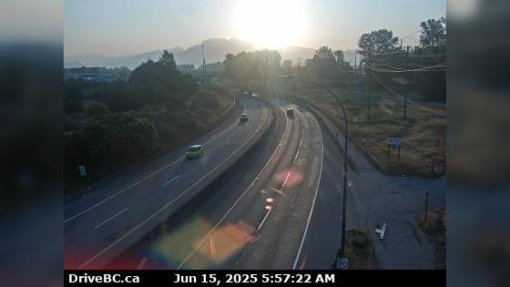
Port Coquitlam › East: Hwy 7B, on Mary Hill, looking east
Port Coquitlam › East: Hwy 7B, on Mary Hill, looking east

Port Coquitlam, BC
Hwy-7B, on Mary Hill, looking southwest. (elevation: 4 metres)
Hwy-7B, on Mary Hill, looking southwest. (elevation: 4 metres)

Port Coquitlam, BC
Hwy-7B, on Mary Hill, looking northeast. (elevation: 4 metres)
Hwy-7B, on Mary Hill, looking northeast. (elevation: 4 metres)

BC
Mary Hill › East: Hwy 7B - Bypass), at Broadway St in Port Coquitlam, looking east
Mary Hill › East: Hwy 7B - Bypass), at Broadway St in Port Coquitlam, looking east

Pitt Meadows, BC
Hwy-7 (Lougheed Hwy) at Kennedy Rd, looking southeast, towards Pitt Meadows. (elevation: 4 metres)
Hwy-7 (Lougheed Hwy) at Kennedy Rd, looking southeast, towards Pitt Meadows. (elevation: 4 metres)

Pitt Meadows, BC
Hwy-7 (Lougheed Hwy) at Kennedy Road, looking northwest towards Pitt River Bridge. (elevation: 4 metres)
Hwy-7 (Lougheed Hwy) at Kennedy Road, looking northwest towards Pitt River Bridge. (elevation: 4 metres)

Pitt Meadows, BC
Hwy-7 (Lougheed Hwy) at Kennedy Road, looking southeast. (elevation: 60 metres)
Hwy-7 (Lougheed Hwy) at Kennedy Road, looking southeast. (elevation: 60 metres)

Pitt Meadows, BC
Pitt Meadows › North-West: Pitt River Bridge
Pitt Meadows › North-West: Pitt River Bridge

Port Coquitlam, BC
Port Coquitlam › East: Hwy 7B (Mary Hill Bypass), at Pitt River Rd, looking east
Port Coquitlam › East: Hwy 7B (Mary Hill Bypass), at Pitt River Rd, looking east

Port Coquitlam, BC
Hwy-7B (Mary Hill Bypass), at Pitt River Rd, looking south. (elevation: 7 metres)
Hwy-7B (Mary Hill Bypass), at Pitt River Rd, looking south. (elevation: 7 metres)

Port Coquitlam, BC
Hwy-7B (Mary Hill Bypass), at Pitt River Rd, looking east. (elevation: 7 metres)
Hwy-7B (Mary Hill Bypass), at Pitt River Rd, looking east. (elevation: 7 metres)

Port Coquitlam, BC
Hwy-7B (Mary Hill Bypass), at Pitt River Rd, looking west. (elevation: 7 metres)
Hwy-7B (Mary Hill Bypass), at Pitt River Rd, looking west. (elevation: 7 metres)

Port Coquitlam, BC
Hwy-7B (Mary Hill Bypass), at Pitt River Rd, looking north. (elevation: 7 metres)
Hwy-7B (Mary Hill Bypass), at Pitt River Rd, looking north. (elevation: 7 metres)

Port Coquitlam, BC
Port Coquitlam › West: Hwy 7B (Mary Hill Bypass), at Pitt River Rd, looking west
Port Coquitlam › West: Hwy 7B (Mary Hill Bypass), at Pitt River Rd, looking west

Pitt Meadows, BC
Hwy-7 (Lougheed Hwy) at Harris Road, looking north. (elevation: 9 metres)
Hwy-7 (Lougheed Hwy) at Harris Road, looking north. (elevation: 9 metres)