
Terrace, BC
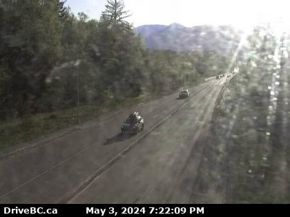
Hwy-16 at Hwy-37 near Terrace, looking south. (elevation: 86 metres)
Hwy-16 at Hwy-37 near Terrace, looking south. (elevation: 86 metres)

Terrace, BC
Hwy-16 at Hwy-37 near Terrace, looking east on Hwy-16. (elevation: 86 metres)
(Camera map is being updated to show this is looking south)
Hwy-16 at Hwy-37 near Terrace, looking east on Hwy-16. (elevation: 86 metres)
(Camera map is being updated to show this is looking south)

Terrace, BC
Hwy-37S at Onion Lake Cross Country ski trails, looking north. (elevation: 220 metres)
Hwy-37S at Onion Lake Cross Country ski trails, looking north. (elevation: 220 metres)

BC
Rosswood › North: Hwy 113 near - about 44 km north of Terrace, looking north
Rosswood › North: Hwy 113 near - about 44 km north of Terrace, looking north

Pacific, BC
Hwy-113 near Rosswood, about 44 km north of Terrace, looking north. (elevation: 176 metres)
Hwy-113 near Rosswood, about 44 km north of Terrace, looking north. (elevation: 176 metres)

Kitimat, BC
Hwy-37 at Oolichan Avenue, 5 km north of Kitimat, looking North (elevation: 46 metres)
Hwy-37 at Oolichan Avenue, 5 km north of Kitimat, looking North (elevation: 46 metres)

Terrace, BC
Hwy-16, at Kasiks resort area, 60 km west of Terrace, looking east. (elevation: 12 metres)
Images provided by Nechako North Coast Road & Bridge with BC Ministry of Transportation and Infrastructure.
Hwy-16, at Kasiks resort area, 60 km west of Terrace, looking east. (elevation: 12 metres)
Images provided by Nechako North Coast Road & Bridge with BC Ministry of Transportation and Infrastructure.

Port Edward, BC
Hwy-16, next to the Skeena River, about 70 KM east of Prince Rupert, looking east. (elevation: 9 metres)
Hwy-16, next to the Skeena River, about 70 KM east of Prince Rupert, looking east. (elevation: 9 metres)

Kitwanga, BC
Junction of Hwy-16 and Hwy-37, near Kitwanga, looking east on Hwy-16. (elevation: 183 metres)
Junction of Hwy-16 and Hwy-37, near Kitwanga, looking east on Hwy-16. (elevation: 183 metres)

Kitwanga, BC
Junction of Hwy-16 and Hwy-37, near Kitwanga, looking north on Hwy-37. (elevation: 183 metres)
Junction of Hwy-16 and Hwy-37, near Kitwanga, looking north on Hwy-37. (elevation: 183 metres)

Kitwanga, BC
Junction of Hwy-16 and Hwy-37, near Kitwanga, looking west on Hwy-16. (elevation: 183 metres)
Junction of Hwy-16 and Hwy-37, near Kitwanga, looking west on Hwy-16. (elevation: 183 metres)

BC
Cedarvale › North: Junction of Hwy 16 and Hwy 37, near Kitwanga, looking north on Hwy
Cedarvale › North: Junction of Hwy 16 and Hwy 37, near Kitwanga, looking north on Hwy

Aiyansh, BC
Hwy-113 at Anlaw Rd, near Gitwinksihlkw, within Nisga'a Memorial Lava Bed Provincial Park, looking east. (elevation: 40 metres)
Hwy-113 at Anlaw Rd, near Gitwinksihlkw, within Nisga'a Memorial Lava Bed Provincial Park, looking east. (elevation: 40 metres)

Kincolith, BC
Hwy-113, near Village of Laxgalts'ap (Greenville) in the Nass Valley, looking eastbound. (elevation: 21 metres)
Hwy-113, near Village of Laxgalts'ap (Greenville) in the Nass Valley, looking eastbound. (elevation: 21 metres)

Regional District of Kitimat-Stikine › East: Hwy 113, near the Village of Laxgalts'ap in the Nass Valley, looking eastbound