
Vanderhoof, BC
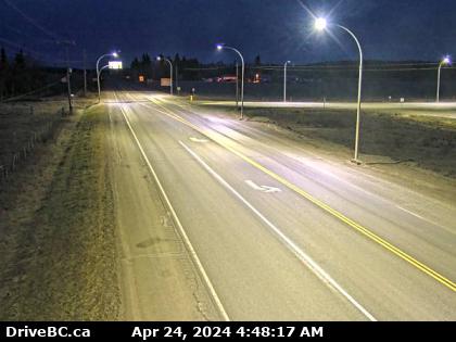
Hwy-16 at Hwy-27 Junction, looking east. (elevation: 654 metres)
Hwy-16 at Hwy-27 Junction, looking east. (elevation: 654 metres)

Vanderhoof, BC
Hwy-16 at Hwy-27 Junction, looking west. (elevation: 654 metres)
Hwy-16 at Hwy-27 Junction, looking west. (elevation: 654 metres)

Vanderhoof, BC
Hwy-16 at Hwy-27 junction, looking north. (elevation: 654 metres)
Hwy-16 at Hwy-27 junction, looking north. (elevation: 654 metres)

Vanderhoof, BC
Vanderhoof › East: Hwy 16 at Hwy 27 Junction, looking east
Vanderhoof › East: Hwy 16 at Hwy 27 Junction, looking east

Braeside, ON
Braeside › North: Hwy 27, about 32 km south of Fort St. James, looking north
Braeside › North: Hwy 27, about 32 km south of Fort St. James, looking north

Fraser Lake, BC
Hwy-16, about 5 km east of Fort Fraser, looking east. (elevation: 800 metres)
Hwy-16, about 5 km east of Fort Fraser, looking east. (elevation: 800 metres)

BC
Fort Fraser › East: Hwy 16, about 5 km east of - looking east
Fort Fraser › East: Hwy 16, about 5 km east of - looking east

Finmoore, BC
Hwy-16 at Sob Lake Road in Vanderhoof, looking east. (elevation: 739 metres)
Hwy-16 at Sob Lake Road in Vanderhoof, looking east. (elevation: 739 metres)

Finmoore, BC
Hwy-16 at Sob Lake Road in Vanderhoof, looking west. (elevation: 739 metres)
Hwy-16 at Sob Lake Road in Vanderhoof, looking west. (elevation: 739 metres)

Fraser Lake, BC
Hwy-16, at Nautley Road, looking north. (elevation: 686 metres)
Hwy-16, at Nautley Road, looking north. (elevation: 686 metres)

Fraser Lake, BC
Hwy-16, at Nautley Road, looking east. (elevation: 686 metres)
Hwy-16, at Nautley Road, looking east. (elevation: 686 metres)

Fraser Lake, BC
Hwy-16, at Nautley Road, looking west. (elevation: 686 metres)
Hwy-16, at Nautley Road, looking west. (elevation: 686 metres)

BC
Area C › South: Hwy 27, about 12km south of Fort St. James at Spencer Pit, looking south
Area C › South: Hwy 27, about 12km south of Fort St. James at Spencer Pit, looking south

BC
Fort St. James › North: Hwy 27 at Hill St/Greenview in - looking north
Fort St. James › North: Hwy 27 at Hill St/Greenview in - looking north

Isle Pierre, BC
Isle Pierre › West: Hwy 16 at Bednesti between Prince George and Vanderhoof, looking west
Isle Pierre › West: Hwy 16 at Bednesti between Prince George and Vanderhoof, looking west